Surprise: discovery of a 3D map dating back to... prehistoric times 🗺️
Published by Cédric,
Article author: Cédric DEPOND
Source: Oxford Journal of Archaeology
Other Languages: FR, DE, ES, PT
Article author: Cédric DEPOND
Source: Oxford Journal of Archaeology
Other Languages: FR, DE, ES, PT
Follow us on Google News (click on ☆)

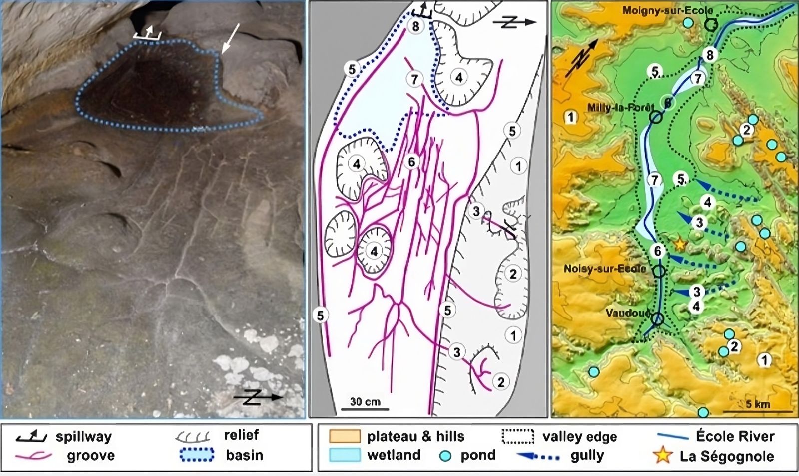
This discovery, dating back to the Upper Paleolithic, challenges our understanding of early spatial representations. The engravings and floor modifications in the Ségognole 3 cave seem to reproduce the surrounding landscape, with its waterways and reliefs. A technical and artistic feat that demonstrates an already sophisticated abstract thought.
A cave with multiple secrets
The Ségognole 3 cave, located in Noisy-sur-École, has been known since the 1980s for its rock engravings, notably two horses framing a female representation. However, it is the floor modifications that have recently captured the attention of scientists. Grooves and depressions, carefully carved, form a complex hydraulic network.
According to researchers, these modifications are not random. They reproduce the hydrographic system of the nearby École valley. Rainwater flowing through these structures once animated this miniature landscape, creating a dynamic and functional representation.
A map or a symbolic model?
Scientists hesitate to classify this discovery as a "map" in the modern sense. It would rather be a three-dimensional model, illustrating the spatial relationships between the elements of the landscape. The hills, rivers, and ponds are represented with astonishing precision, suggesting a deep understanding of the environment.
However, the purpose of this creation remains mysterious. Was it a pedagogical tool, a support for water-related rituals, or simply an artistic work? Researchers lean towards a symbolic meaning, related to life and nature, although this interpretation remains speculative.
A discovery that illuminates the past
This prehistoric map, nearly 20,000 years old, pushes the boundaries of our knowledge of Paleolithic societies. It reveals an ability to conceptualize and reproduce space, long before the invention of writing or modern maps.
The techniques used to create this model, as well as its complexity, highlight the ingenuity and creativity of the people of that time. This discovery opens new perspectives on the cultural practices and technical knowledge of Paleolithic hunter-gatherers.