Polar vortex breaks off: towards a historic cold wave in the United States ❄️
Follow us on Google News (click on ☆)

This cold wave, fueled by large-scale pressure changes and a disruption of the polar vortex, is expected to bring the coldest air of the season. The southeastern United States could experience dangerous wind chills, while heavy snowfall is expected in the Appalachians, the Ohio Valley, and the northeastern part of the country.
Temperatures could drop up to 30 degrees Fahrenheit below seasonal averages, with possible frost reaching the Gulf of Mexico and the Florida peninsula. This situation could even affect iguanas, which, paralyzed by the cold, might fall from trees.
According to AccuWeather, this January could be the coldest in over a decade. The Arctic cold episode is expected to persist until mid-January, with high Arctic pressures moving towards the southern United States.
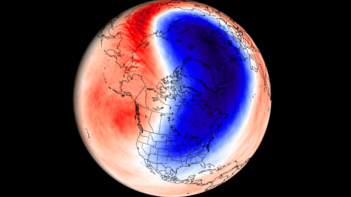
The polar vortex, a low-pressure area of cold air circulating around the poles, plays a key role in this cold wave. This year, two high-pressure zones are directing cold air from Canada towards the eastern United States, increasing the risk of winter storms.

The consequences could be severe, with possible damage to power grids, significant snowfall, and risks of frozen pipes in southeastern states. Cities like New York, Chicago, and Washington D.C. could be particularly affected.
Finally, if the cold persists beyond mid-January, January 2025 could be the coldest since 2014 in some regions, with temperatures well below historical averages.

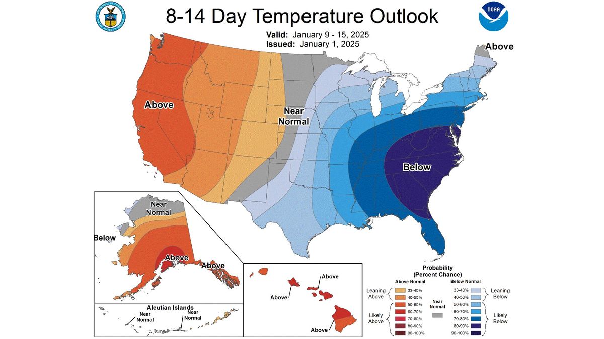
Temperature forecast map from January 9 to 15 showing the cold in the eastern United States.
Credit: NOAA
What is the polar vortex?
The polar vortex is a vast area of low pressure and cold air that surrounds the Earth's poles. It is present year-round but intensifies in winter in the northern hemisphere, influencing large-scale weather conditions.
This phenomenon is crucial for understanding extreme cold waves. When the polar vortex is disrupted, it can send cold air masses to lower latitudes, as is currently observed in the United States.
Scientists are studying changes in the polar vortex to better predict extreme weather events. This research is essential for anticipating and mitigating impacts on populations and infrastructure.
Why do iguanas fall from trees in Florida?
Iguanas, reptiles native to tropical regions, are particularly sensitive to cold. When temperatures drop below a certain threshold, they enter a state of temporary paralysis.
This state, called torpor, is a physiological response to cold. Iguanas then lose their ability to hold onto branches, which explains why they can fall from trees during cold waves.
Although this situation is often perceived as anecdotal, it illustrates the impact of extreme weather conditions on wildlife. Biologists emphasize the importance of protecting vulnerable species during such events.