A major modification of the Nile 4000 years ago may have defined ancient Egypt
Follow us on Google News (click on ☆)

According to a study published in Nature Geoscience, this change led to a significant expansion of the floodplain around Luxor, greatly increasing arable land and soil fertility. Researchers suggest this may have supported Egypt's agricultural economy between the Old and New Kingdoms, a period of great prosperity and cultural achievements.
Dr. Benjamin Pennington from the University of Southampton explains that this expansion allowed for the regular deposition of fertile silt, enriching agricultural lands. Although direct links between this change and contemporary social developments are difficult to establish, it is crucial to consider these landscape modifications in Egyptian history.
The study, conducted by an international team led by Dr. Angus Graham of Uppsala University, also suggests that these changes in the Nile influenced settlement patterns and the location of iconic structures like the Karnak Temple.
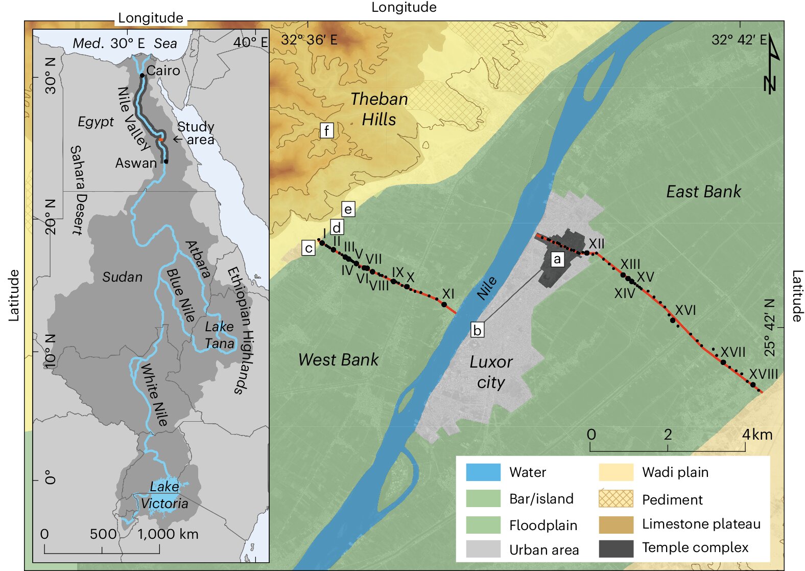
Dominic Barker, another co-author of the study, describes how 81 drillings were carried out throughout the Nile Valley near Luxor, a first in Egypt. By analyzing geological information and dating sediments through optically stimulated luminescence, the team was able to trace the evolution of the river landscape.

Geomorphic map of the Nile Valley near Luxor, Egypt.
Credit: Nature Geoscience (2024). DOI: 10.1038/s41561-024-01451-z
Between 11,500 and 4,000 years ago, the Nile deeply carved its valley, forming deep channels and narrowing its floodplain, which likely caused more intense flooding. This river behavior persisted from the Epipaleolithic period through the Old Kingdom, and perhaps even into the Middle Kingdom.
Finally, the study indicates that starting 4,000 years ago, the Nile became a more stable system of channels due to a decrease in water flow and an increase in fine sediments. These changes are linked to the drying of the Nile basin and the transformation of the "Green Sahara" into a hyper-arid desert.
This geographical context offers new perspectives for archaeologists to reinterpret ancient sites and rethink settlement locations in the Nile Valley.